
Shenandoah Valley hiking trails give you the same layered Blue Ridge views people drive the Parkway for, with summit scrambles, waterfalls, and quiet loops spread across Shenandoah National Park. This guide covers seven of the best hikes near Luray, with the distance, elevation gain, difficulty, dog rules, and milepost for each, all checked against the National Park Service, to help you plan your day.
We manage Skyline Vista Retreat, a mountain lodge in Luray, 15 to 20 minutes from the Thornton Gap entrance. The last section covers the lodge and its drive times.
Here are the seven hikes at a glance:
- Blackrock Summit: 1 mile round trip, 175 feet of gain, rated easiest.
- Bearfence Mountain: 1.4 miles round trip, 311 feet of gain, rated moderate, with a rock scramble.
- Dark Hollow Falls: 1.4 miles round trip, 440 feet of gain, rated moderate, with a steep return climb.
- Hawksbill Summit: 1.7 miles round trip, 690 feet of gain, rated moderate, the park’s highest peak.
- Mary’s Rock: 3.7 miles round trip, 1,210 feet of gain, rated moderate, closest to Luray.
- Rose River Loop: 4 miles round trip, 910 feet of gain, rated moderate, a waterfall loop that allows leashed dogs.
- Old Rag: 9.4 miles round trip, 2,348 feet of gain, rated very strenuous, a full-day rock scramble.
The 7 best hikes in Shenandoah National Park near Luray
Old Rag: a very strenuous full-day circuit
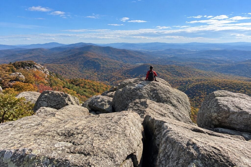
Old Rag is the best known hike in the park, famous for its rock scramble and a 360-degree summit view across the Virginia Piedmont on one side and the Shenandoah Valley on the other. The Park Service lists the Old Rag Circuit at 9.4 miles with 2,348 feet of elevation gain and rates it very strenuous, with a typical time around seven and a half hours. The scramble near the top means using both hands over and between boulders, so plan for a full day. Old Rag uses a separate park-boundary trailhead rather than a Skyline Drive parking area. Pets are prohibited on Old Rag’s Ridge, Saddle, and Ridge Access trails.
From March 1 to November 30, every visitor, including children, needs a $2 Old Rag day-use ticket in addition to the park entrance pass. Tickets are released 30 days and five days ahead. Buy before arriving and confirm current requirements on the NPS ticket page. As of October 18, 2026, the main Old Rag trailhead parking lot is closed for construction expected to finish in November. Use the existing overflow lots and check the NPS Old Rag page before traveling. A day-use ticket does not guarantee parking. For the full breakdown, see our guide to the Old Rag Mountain hike.
Mary’s Rock: the big view closest to Luray
If you want a real summit view without driving deep into the park, Mary’s Rock sits right at the Thornton Gap entrance, the closest gateway to Luray. From the Panorama parking area at Skyline Drive mile 31.6, the Park Service lists a 3.7-mile round trip with 1,210 feet of gain, rated moderate. A shorter alternate to Mary’s Rock begins at the Meadow Spring parking area farther south on Skyline Drive; check the NPS Thornton Gap trail map for the route and distance. Leashed dogs are allowed. The payoff is a wide look over the valley and the ridgelines to the west, and because it is the first climb inside the Thornton Gap entrance, it pairs easily with a slow afternoon back in town.
Hawksbill Summit: the highest peak in the park
Hawksbill is Shenandoah’s highest peak at 4,051 feet, and the summit has an observation platform built for the near 360-degree view. The shortest common route climbs 1.7 miles round trip with 690 feet of gain from the Hawksbill Gap parking area at mile 45.5, rated moderate. The Upper Hawksbill route starts at mile 46.5 and is 2.1 miles round trip with 520 feet of elevation gain, rated easiest by NPS. Leashed dogs are allowed. It pairs well with Dark Hollow Falls or Rose River Loop, which sit within a short stretch of Skyline Drive. For sunset, arrive early enough to claim a spot at the platform railing.
Bearfence Mountain: a short rock scramble
Bearfence is a short hike with a hands-on rock scramble. NPS warns that the scramble is unsafe when wet or icy and unsuitable for hikers afraid of heights. The Park Service lists the Bearfence Rock Scramble at 1.4 miles round trip with 311 feet of gain from the parking area at mile 56.4, rated moderate, and it requires using your hands to climb over rock to reach a 360-degree view. If you would rather skip the scramble, the Bearfence Viewpoint route is 1.1 miles to a 180-degree overlook. Pets are not permitted on either route. The pull-off is small, so a weekday or an early start helps.
Dark Hollow Falls: a short, steep waterfall hike
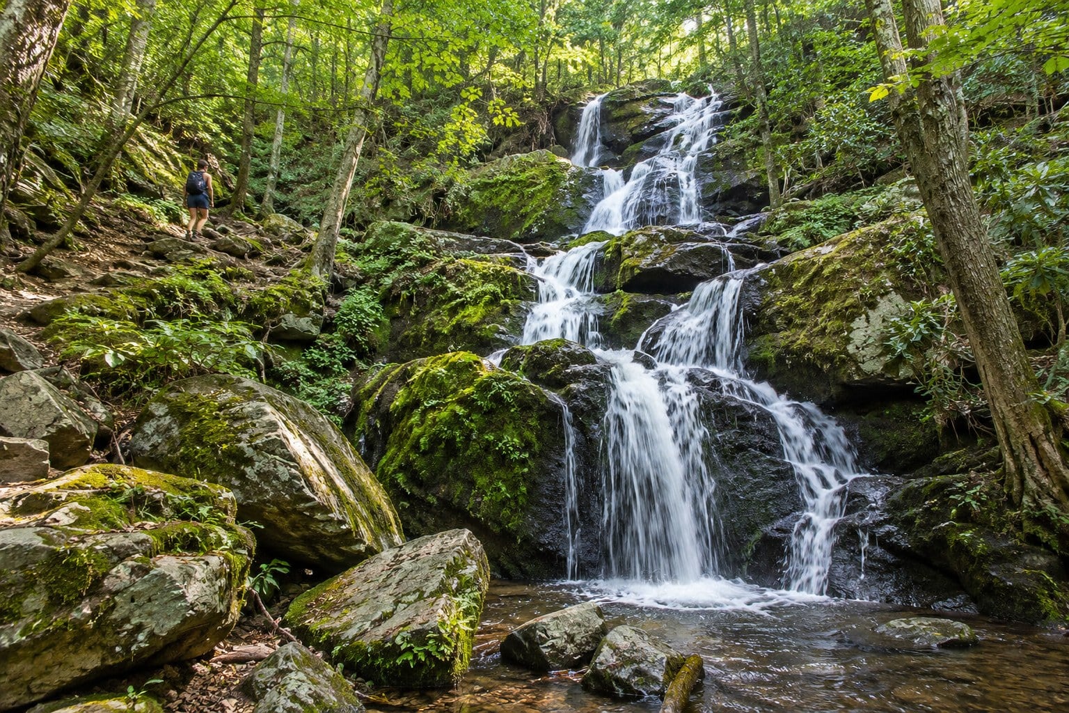
Dark Hollow Falls is a short waterfall hike with a steep return climb. The Park Service lists it as a 1.4-mile circuit with 440 feet of gain from the parking area at mile 50.7, rated moderate. It is short but steep and rocky, and the climb back up is the hard part. Pets are not permitted on this trail. If you are hiking with a dog, the nearby Rose River Loop allows leashed pets.
Rose River Loop: a waterfall loop that welcomes dogs
Rose River Loop is the waterfall option for groups hiking with a dog. The Park Service lists it as a 4-mile circuit with 910 feet of gain from the Fishers Gap parking area at mile 49.4, rated moderate, with a 67-foot waterfall partway around. Leashed dogs are allowed, and the forested stream sections give photographers moving water and canopy light to work with. The return includes a steep, rocky section past cascades.
Blackrock Summit: a short hike to valley views
Blackrock Summit is the shortest hike on this list, and it still ends at a real view. Its trailhead is 52.9 miles south of Thornton Gap along Skyline Drive, so factor that drive into a day based in Luray. The Park Service lists a 1-mile circuit with 175 feet of gain from the Blackrock parking area at mile 84.4, rated easiest, ending on a rocky talus slope with open views of the Shenandoah Valley and Massanutten Mountain. Leashed dogs are allowed, the terrain stays gentle, and the open sky makes it a good spot to watch the sunset. Bring a headlamp if you stay for the colors, since the walk back is easy but unlit.

Compare Shenandoah Valley hiking trails and consider a Parkway outing
Skyline Drive runs 105 miles through Shenandoah National Park. The table below compares seven routes by distance, elevation gain, difficulty, pet rules, and access point. For a separate Parkway outing, Humpback Rocks is reached from Humpback Gap parking at milepost 6. The Park Service describes the climb to the rocks as about a mile of strenuous ascent gaining close to 700 feet, with views over the Rockfish and Shenandoah valleys.
Trail details at a glance
| Trail | Round trip | Elevation gain | Difficulty | Dogs | Access point |
|---|---|---|---|---|---|
| Old Rag Circuit | 9.4 miles | 2,348 ft | Very strenuous | Not permitted | Old Rag parking area (day-use ticket) |
| Mary’s Rock | 3.7 miles | 1,210 ft | Moderate | Leashed | Panorama, Skyline Drive mile 31.6 |
| Hawksbill Summit | 1.7 miles | 690 ft | Moderate | Leashed | Hawksbill Gap, mile 45.5 |
| Bearfence Rock Scramble | 1.4 miles | 311 ft | Moderate (scramble) | Not permitted | Skyline Drive mile 56.4 |
| Dark Hollow Falls | 1.4 miles | 440 ft | Moderate | Not permitted | Skyline Drive mile 50.7 |
| Rose River Loop | 4 miles | 910 ft | Moderate | Leashed | Fishers Gap, mile 49.4 |
| Blackrock Summit | 1 mile | 175 ft | Easiest | Leashed | Skyline Drive mile 84.4 |
Parking, mileposts, and total trip time
The park’s Skyline Drive has a speed limit of 35 mph in most places and four entrance stations: Front Royal at mile 0, Thornton Gap at mile 31.5, Swift Run Gap at mile 65.5, and Rockfish Gap at mile 104.6. Thornton Gap is the nearest to Luray. Include driving, hiking, rest stops, and parking in your day’s plan.
Here is a framework that works for most single-day plans:
- Use each trailhead’s milepost to calculate the road distance between stops, then allow additional time for traffic, overlooks, and parking.
- Estimate hiking time by your pace, not distance alone. A short scramble like Bearfence can take about an hour round trip, while a flatter loop can run longer than its mileage suggests.
- Add 20 to 30 minutes at any summit or waterfall for photos and rest, especially at popular spots like Hawksbill or Dark Hollow Falls.
- For sunset hikes like Blackrock, work backward from sunset, allow enough time for the full return hike, and carry a headlamp.
Allow extra time to find parking and choose a backup hike before leaving. Follow the current Old Rag parking instructions linked above. Check the Skyline Drive status page before you head out, since sections occasionally close for weather or maintenance.
Which trails work best for families, dogs, and photographers
Trail choice depends on who is in your group, since dog rules, scramble sections, and elevation gain vary a lot across these seven hikes.
Families with young children should start by considering Blackrock Summit, the shortest and lowest-gain route in this table. Dark Hollow Falls has a steep return climb. Rose River Loop is four miles with 910 feet of elevation gain, so choose it only if that matches your children’s hiking experience.
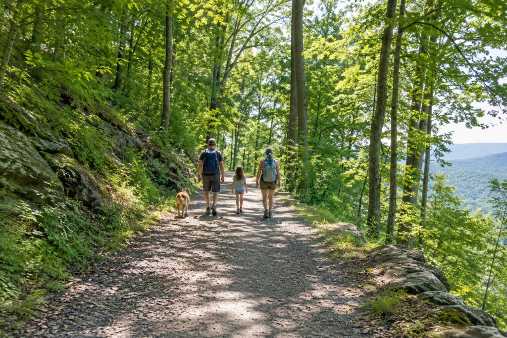
Dog owners should plan around the pet rules. Leashed dogs are allowed on Mary’s Rock, Hawksbill Summit, Rose River Loop, and Blackrock Summit. Pets must stay on a physical leash no longer than six feet. Pets are prohibited on Old Rag’s Ridge, Saddle, and Ridge Access trails, on Bearfence, and on Dark Hollow Falls. Always confirm the current pet policy for a specific trail with the park before you go.
Photographers who want one wide, dramatic frame should prioritize Hawksbill Summit and its platform. Rose River Loop offers waterfall and stream scenes. Blackrock’s open talus slope works for sunset shots.
Permits, fees, and seasons to know
Shenandoah National Park charges a $30 vehicle entrance fee that is good for seven consecutive days (confirm current rates on the park’s fees page before you go). Old Rag adds the $2 day-use ticket from March 1 to November 30, booked through Recreation.gov, and that ticket does not guarantee a parking spot.
Check the park’s weather and current trail conditions before you hike, especially before an exposed summit or a loop like Rose River. Fall color varies by elevation, location, and weather. Check the park’s current fall color updates before choosing your dates. Fall weekends can be busy, so consider a weekday visit. See our guide to Shenandoah fall foliage on Skyline Drive for timing. In winter, Skyline Drive closes sections during snow and ice, so check road status before driving out.
Where to stay for easy access to the trails
Luray is a base for entering the park at Thornton Gap. Compare the drive to your chosen trailhead before booking. Our guide to where to stay in the Shenandoah Valley breaks down the trade-offs by area.
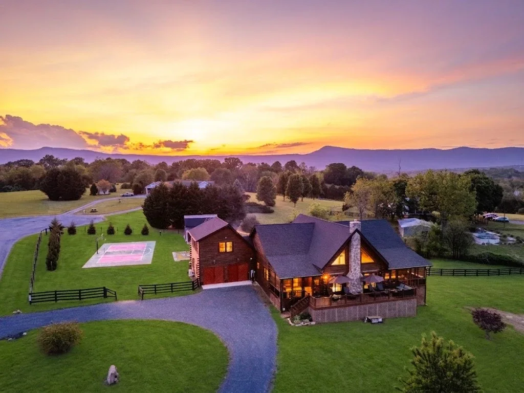
We manage Skyline Vista Retreat, our only Luray home. It is a five-bedroom log lodge on three private acres with the Blue Ridge out the windows. It sleeps 10 across nine beds and two and a half baths: a king primary suite with its own bath, a loft with two queen beds open to the great room, two more queen rooms, and a kids’ bunk room with two full bunk beds.
The lodge has a private hot tub on the deck, open year-round, and a cedar barrel sauna with a mountain view. Beyond those, the property has a full-size pickleball court, an arcade game room with a pool table, foosball, retro machines, and a life-size chess board, a home gym with a Peloton and a yoga studio on the gym’s top floor, a fire pit with Adirondack chairs and a complimentary s’mores kit, backyard mini-golf, and a gas grill. For anyone working a day of the trip, there is Starlink Wi-Fi and a dedicated workspace.

From the lodge, downtown Luray is 5 to 10 minutes away and Luray Caverns is 10 to 15 minutes. The Thornton Gap entrance and Skyline Drive are 15 to 20 minutes out, and the Shenandoah River is 15 to 25 minutes, where local outfitters rent canoes, kayaks, and tubes with a shuttle. Old Rag is 40 to 50 minutes, and Massanutten Resort is 45 to 60. Those distances make it realistic to fit a summit or a Skyline Drive overlook into the morning and still be back for a soak before dinner.
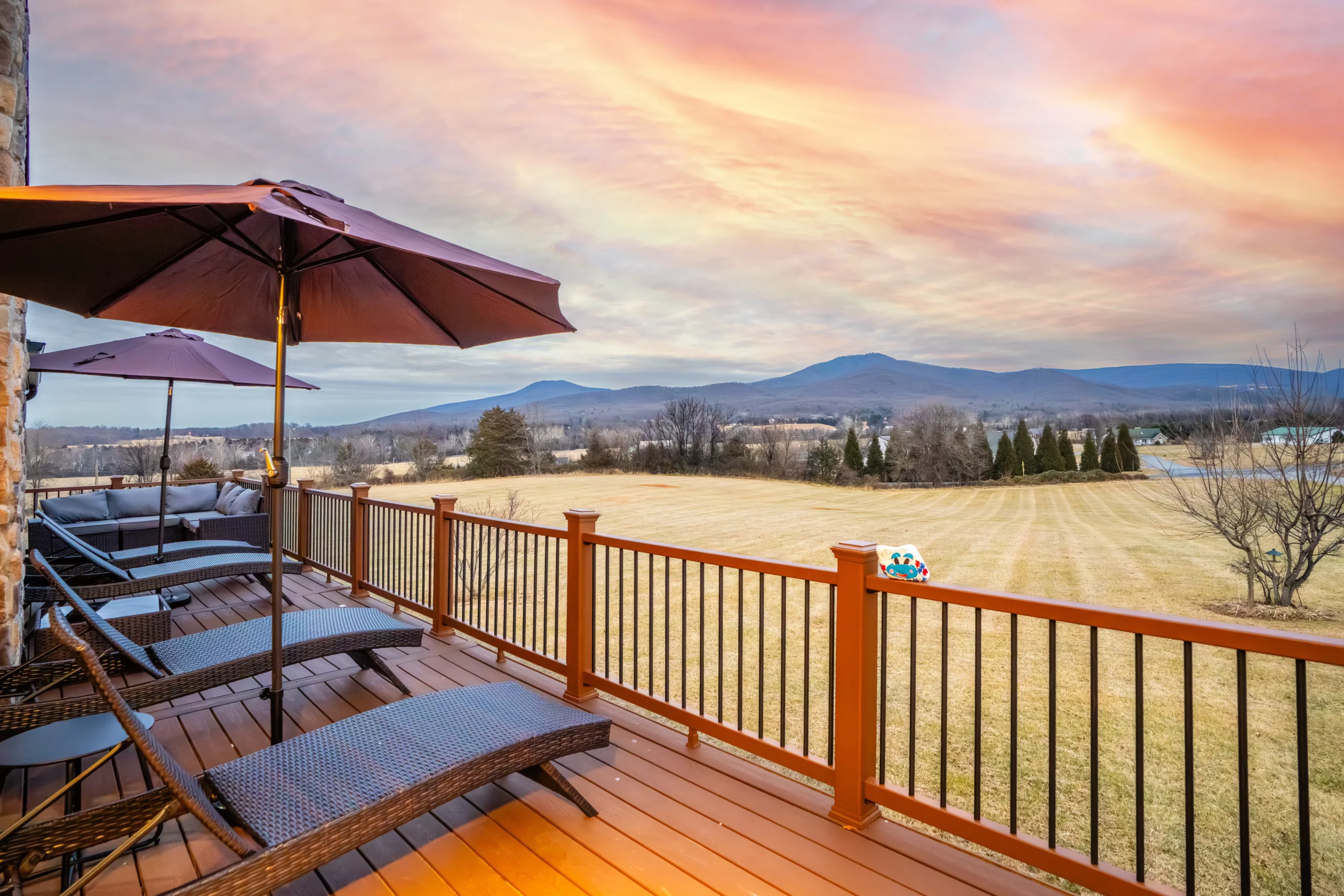
The lodge is a 5.0 Airbnb Guest Favorite with eight five-star reviews. One guest, Jia, wrote: “The views are magnificent and the cabin is spacious. The game room kept the kids entertained for hours, and soaking in the hot tub was pure magic under the stars. We can’t wait to come back.”
House rules are no pets, no smoking, and no parties, and the person booking needs to be 30 or older. Check-in is keyless after 4 PM and checkout is 10 AM. If you book direct, you can cancel for a full refund more than 30 days out and get half back more than 14 days out, with no third-party service fee. The Airbnb listing for the same lodge is strict and non-refundable. Message us and you will usually hear back within the hour.
Frequently asked questions
What is the most popular hike in Shenandoah National Park?
Old Rag is widely considered the most popular hike in the park, drawing hikers for its rock scramble and 360-degree summit view. The Park Service lists the circuit at 9.4 miles with 2,348 feet of elevation gain, and it needs a day-use ticket from March 1 to November 30.
What is the easiest hike with a real view?
Blackrock Summit is one of the easiest hikes in the park that still ends at a genuine view. It is a 1-mile circuit with about 175 feet of elevation gain, rated easiest, and it allows leashed dogs, which makes it a strong pick for families or a first time in the park.
Which Shenandoah Valley hiking trails allow dogs?
Leashed dogs are allowed on Mary’s Rock, Hawksbill Summit, Rose River Loop, and Blackrock Summit. Pets are prohibited on Old Rag’s Ridge, Saddle, and Ridge Access trails, on Bearfence, and on Dark Hollow Falls. Always confirm the current pet policy for a specific trail with the park before bringing a dog.
Do I need a permit or ticket to hike Old Rag?
Yes. Old Rag requires a $2 day-use ticket from March 1 to November 30, booked through Recreation.gov, in addition to the standard park entrance pass. Current requirements can change, so confirm with the National Park Service before you drive out.
How far is Luray from the park entrance?
Thornton Gap is the park entrance near Luray, at Skyline Drive mile 31.5. Check the drive from your specific starting address.
When is the best time to hike for fall color?
Fall color varies by elevation, location, and weather. Check the park’s current fall color updates before choosing your dates. Fall weekends can be busy, so consider a weekday visit.
Planning your Shenandoah Valley hiking trip
Choose a hike that fits your group’s experience, check current trail and parking conditions, and include driving and rest stops in your plan.
If a five-bedroom lodge near the Thornton Gap entrance fits your group, see Skyline Vista Retreat availability before you set your trail dates.
Own a home near Luray? See how our Airbnb management in the Shenandoah Valley works.